
Smartfin enables cutting edge research in coastal ecosystems.
Traditional measurement methods in the nearshore and surf zone are challenging and expensive, and this critical area of measurement is always under-sampled. The aggressive nearshore environment is precisely where surfers choose to spend their time. Smartfins can affordably gather, in near-real time, coastal data across the globe.
The science
-
There is considerable research on the consequences of rising water temperatures on our oceans, but little is known about the impact of these increased temperatures on coastal ecosystems. None of the traditional methods for collecting oceanographic data are ideal for studying the nearshore ecosystem.
Satellite acquired data, while accurate for the open ocean, is not accurate for coastal regions. Traditional buoys and moored sensors cannot withstand the persistent punishment of coastal ocean waves and are too expensive to be deployed in large numbers.
Smartfins deployed in large numbers can affordably gather, in near-real time, coastal data across the globe.
-
The global ocean may be the most critical part of Earth’s environmental system. Since the Industrial Revolution, the ocean has absorbed 90% of the excess heat from global warming and half of the excess carbon dioxide.
The nearshore coastal zones are highly productive, rich in biodiversity, and are where the vast majority of human activity occurs. Coral reefs and mangroves, both sources of blue carbon and protection against coastal erosion, and fisheries all inhabit the nearshore zone.
Because coastal zones are so dynamic, it is challenging and expensive to measure the trends and effects of climate change in these areas. As a result, scientists do not have consistent, reliable nearshore data and our understanding of climate change in our coastal zones remains incomplete.
-
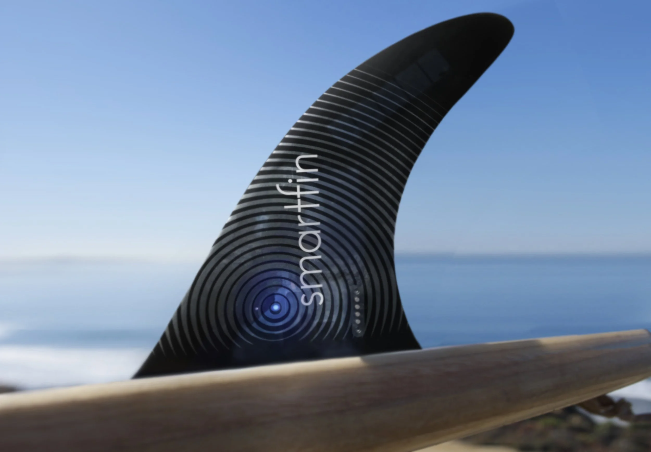
Smartfin is a patented, Internet of Things (IoT) enabled longboard fin for surfing and paddle boarding with embedded sensor technology that enables citizen scientists to measure water chemistry. The device provides near real-time data, with high spatial and temporal resolution, to researchers through a cloud database.
Smartfin is a longboard fin, and turns on automatically in salt water via a wet/dry sensor. It records GPS, temperature, and wave data while in the water, and then automatically transmits the data via LTE signal.
After calibration, temperature data are accurate to ±0.05ºC.
-
Smartfin data are useful for a range of oceanographic applications, including changes in temperature, water quality, coastal physics such as riptides and changing swell patterns, and validating satellites. Two ongoing examples are:
Coral Bleaching Disease: With Smartfin data, scientists can understand micro-habitat changes in temperature, so that coral reefs can be restored in places with habitable temperatures.
Glacier Retreat: Smartfin data feed models that enable communities to anticipate how much sea level will rise, and how quickly.
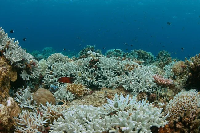
Smartfin and coral reefs
Coral reefs are a big reason that the coastal zone of the ocean is teeming with life. Though coral cover about 1% of the ocean floor, they support about 25% of marine life, and protect against coastal erosion.
Coral are being decimated by climate change and other anthropogenic disturbances. We’ve lost 20% of coral reefs in the last few decades, and are on track to lose 50% of remaining reefs by 2050. As ocean temperatures and pH rise, corals are frying in place, and are unable to repair their skeletons.
Satellite and buoy data are useful across big spatial realms, but coral bleaching on a reef is very spotty and we don't really know why. Smartfin data aid in understanding how rising temperatures due to climate change are affecting sensitive ocean habitats because Smartfin can measure temperature across very small spatial and time scales.
Coral reefs are where some of the best surf breaks are; with Smartfin, every surfer out on these iconic reef breaks will support research to protect coral.
Featured published work
Comparison of a Smartfin with an Infrared Sea Surface Temperature Radiometer in the Atlantic Ocean
Expanding Aquatic Observations through Recreation
Validation of Landsat 8 high resolution Sea Surface Temperature using surfers